Missouri National Recreational River
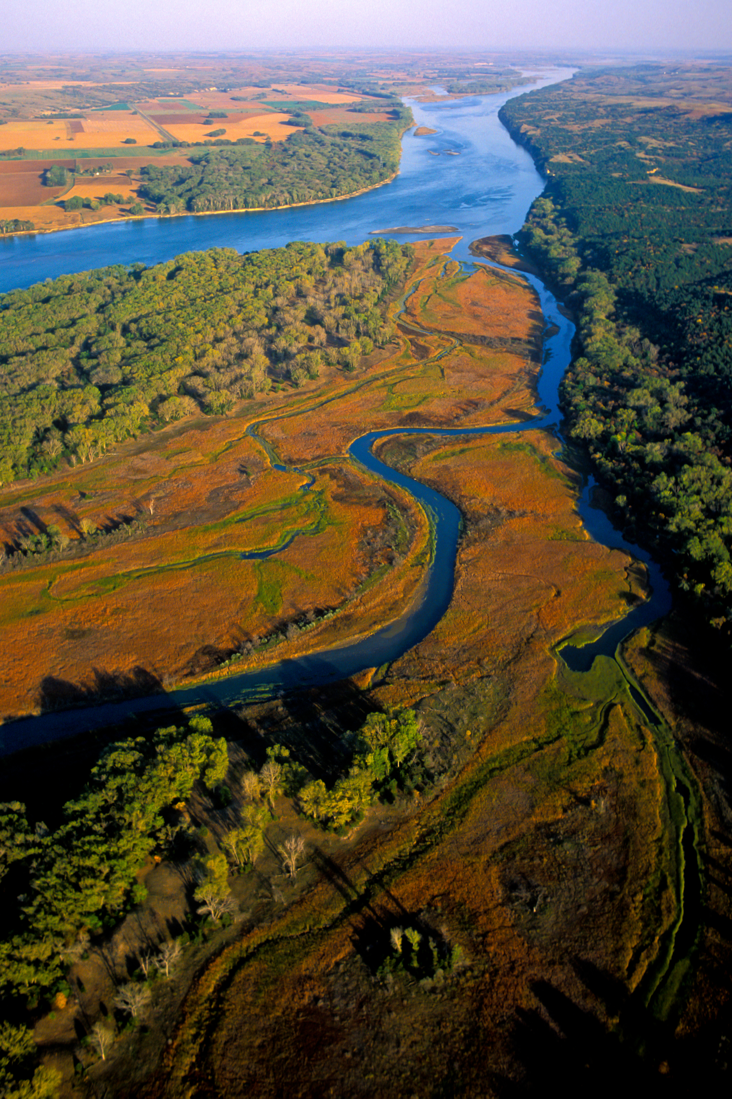
You will find Missouri National Recreational River in South Dakota and Nebraska, managed so the river's character, banks, and shoreline values are preserved together. Imagine a 100-mile stretch of North America's longest river, a vestige of the untamed American West. The Missouri National Recreational River is where imagination meets reality.
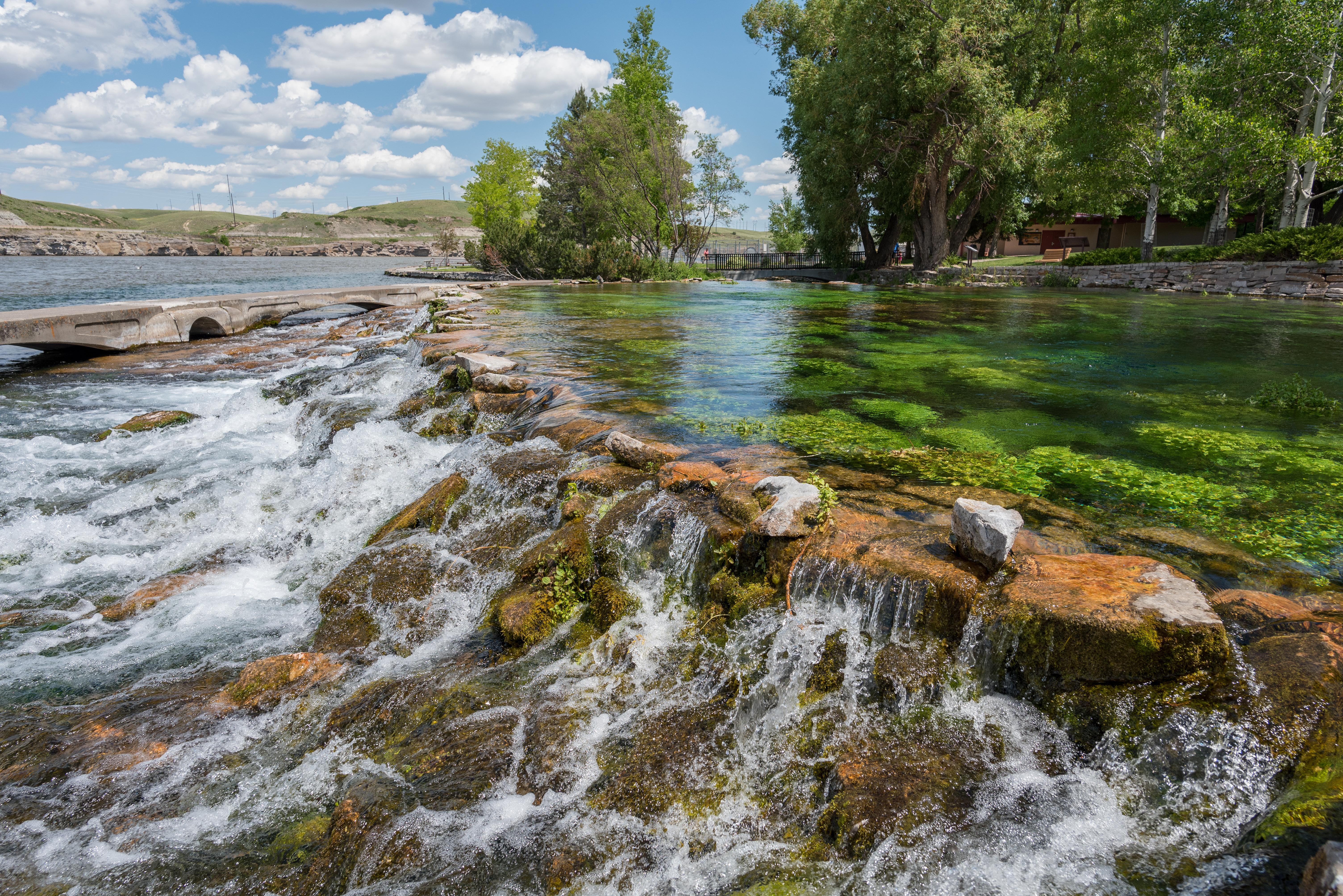
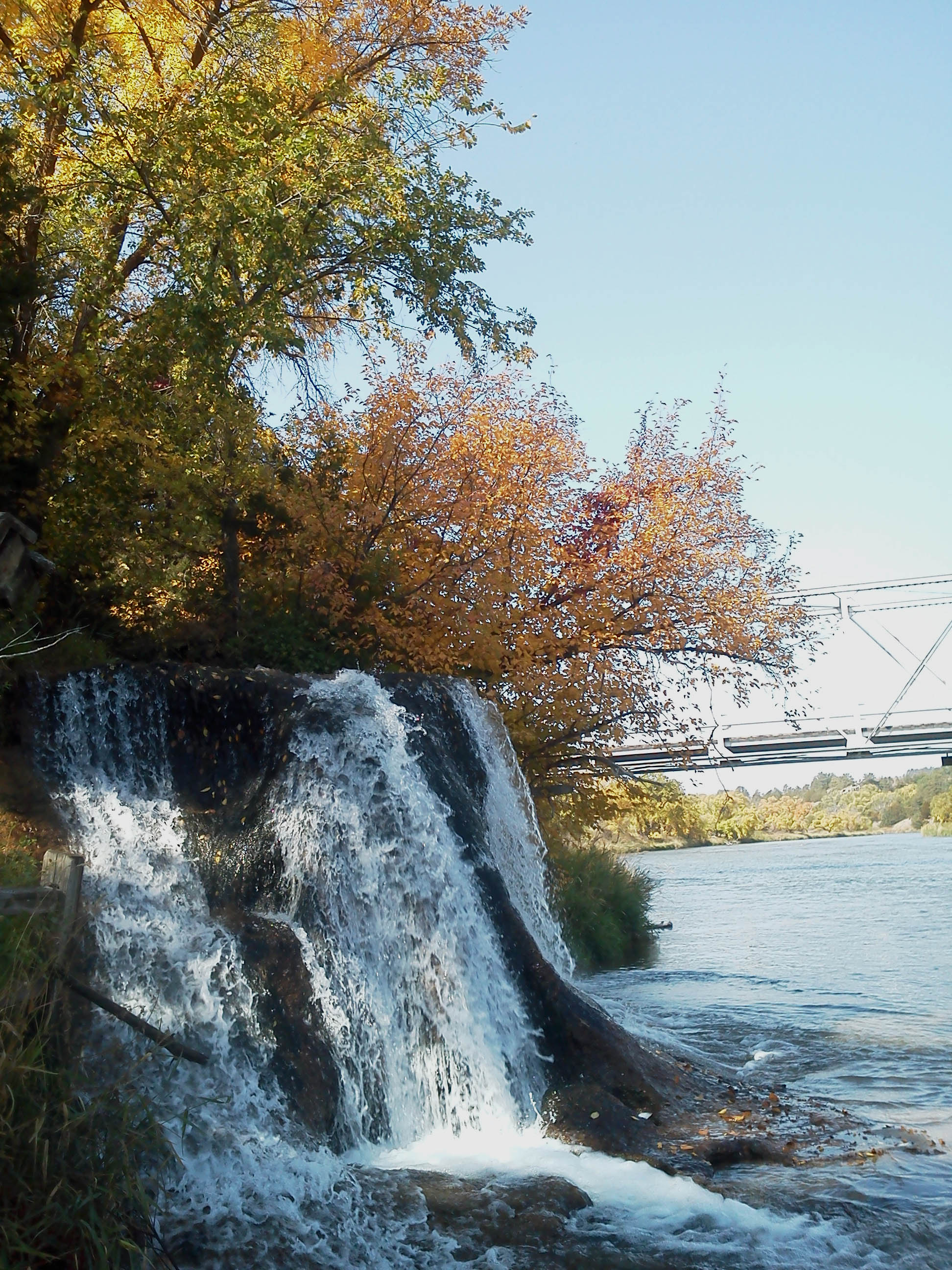
Two free flowing stretches of the Missouri make up the National Park. Relive the past by exploring the wild, untamed and mighty river that continues to flow as nature intended.
Because Missouri National Recreational River is a federally protected river, its banks, flows, and riparian habitats are managed as one connected system.
Key Highlights
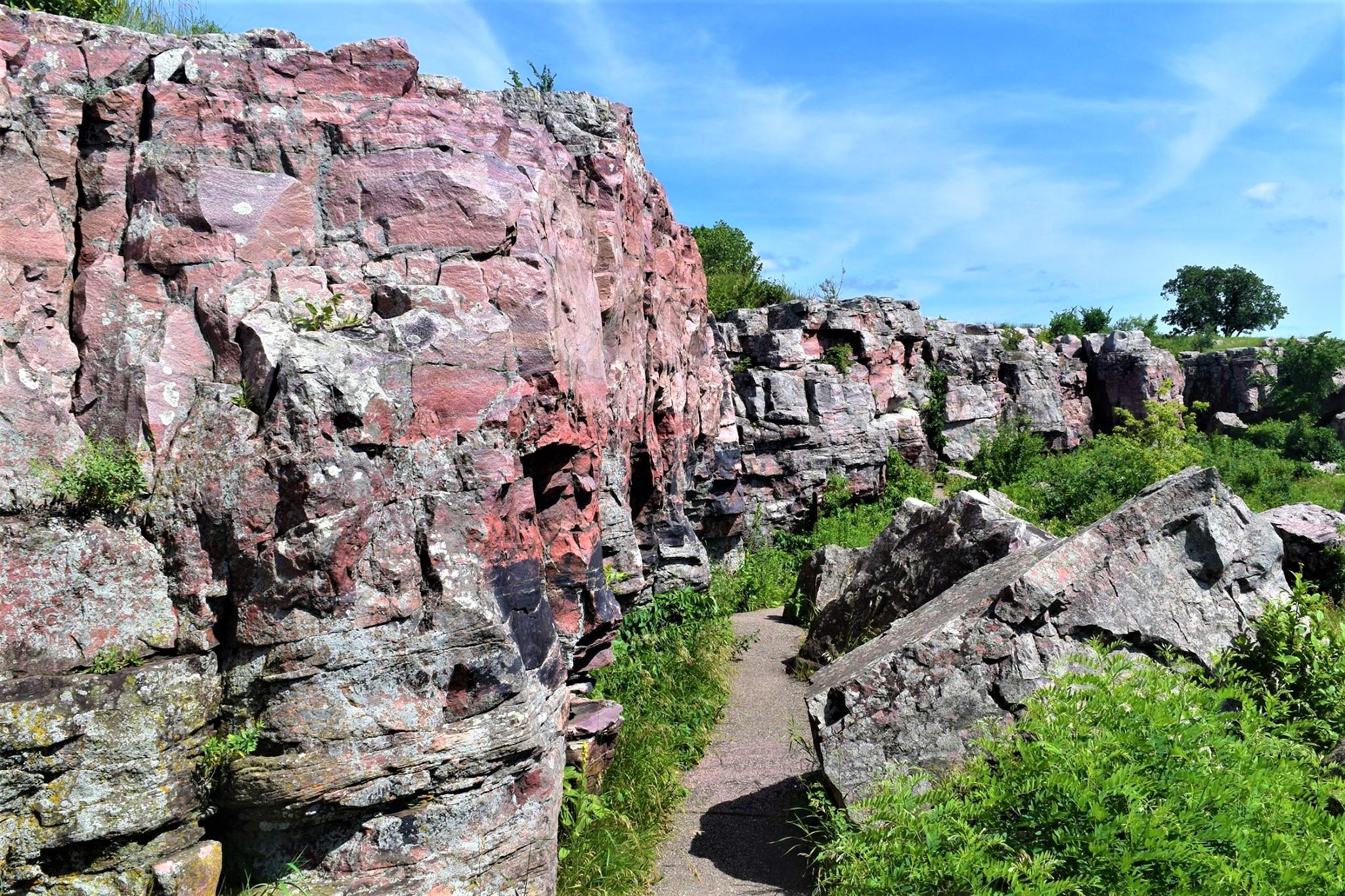
- Archeology
- Ruins
- Dams
- Engineering
- Hunting
- Bookstore and Park Store
- Stargazing
Getting There
Reaching Missouri National Recreational River is straightforward once you know the route. The National Park Service headquarters is located at 508 East Second Street in Yankton, South Dakota.
By Car
Most visitors arrive by private vehicle or rental car. Road conditions vary with weather and construction, so check the park's alerts page the day before you travel. Pay attention to GPS directions in rural stretches—some apps route drivers onto unmaintained service roads rather than the signed park entrance.
Nearest Airports
Regional airports provide the most convenient access for long-distance travelers. For the most current airline service and driving distances, cross-reference flight options with the park's contact page. Budget extra drive time from any airport, especially if you arrive after dark or during winter weather.
Public Transit and Tours
Direct public transit is limited at most National Park Service sites, but guided day tours and shuttles sometimes operate from nearby cities during peak season. Rideshare options are often reliable in gateway towns but may drop off outside the park boundary rather than at specific trailheads or visitor centers.
For turn-by-turn directions and current road status, consult the park's official directions page: http://www.nps.gov/mnrr/planyourvisit/directions.htm.
Best Time to Visit
Weather shapes every visit. Rapid weather changes are common along the Missouri National Recreational River corridor. Variations from season to season and from year to year are great. Characteristics of the climate are hot summers and cold winters. Sunshine is abundant, particularly in the summer months. Average annual rainfall is 25 inches. Thunderstorms can be dangerous and visitors should be prepared for them, especially from June until late August. Winter snowfall averages 34 inches annually.
Spring (March – May)
Spring runoff raises water levels, creating excellent paddling conditions for experienced boaters and challenging ones for beginners.
Summer (June – August)
Summer is peak paddling and swimming season, with warm water and steady outfitter service.
Fall (September – November)
Fall delivers cooler temperatures and scenic color along the banks, with lower, clearer water.
Winter (December – February)
Winter use is minimal, but shoreline hiking and wildlife viewing remain rewarding for prepared visitors.
Activities and Adventures
Activities at Missouri National Recreational River reflect the character of the site. The options below are drawn from the park's current published list—confirm availability and any required reservations before planning around a specific activity.
- Auto and ATV — ask at the visitor center for current conditions, reservations, and any required permits.
- Scenic Driving — ask at the visitor center for current conditions, reservations, and any required permits.
- Astronomy — ask at the visitor center for current conditions, reservations, and any required permits.
- Stargazing — ask at the visitor center for current conditions, reservations, and any required permits.
- Biking — confirm which roads and paths allow bikes and whether rentals are available in the gateway community.
- Road Biking — confirm which roads and paths allow bikes and whether rentals are available in the gateway community.
- Boating — water levels and wind shift quickly—plan around weather and consult rangers about current conditions.
- Camping — check campground availability and reservation windows in advance, especially on weekends and holidays.
- Canoe or Kayak Camping — check campground availability and reservation windows in advance, especially on weekends and holidays.
- Car or Front Country Camping — check campground availability and reservation windows in advance, especially on weekends and holidays.
- Group Camping — check campground availability and reservation windows in advance, especially on weekends and holidays.
- RV Camping — check campground availability and reservation windows in advance, especially on weekends and holidays.
- Fishing — a state fishing license is typically required; check current regulations for species and gear limits.
- Freshwater Fishing — a state fishing license is typically required; check current regulations for species and gear limits.
- Food — ask at the visitor center for current conditions, reservations, and any required permits.
- Dining — ask at the visitor center for current conditions, reservations, and any required permits.
- Picnicking — ask at the visitor center for current conditions, reservations, and any required permits.
- Guided Tours — schedules rotate seasonally; check the visitor center board on arrival for the current lineup.
- Self-Guided Tours - Walking — schedules rotate seasonally; check the visitor center board on arrival for the current lineup.
- Hands-On — ask at the visitor center for current conditions, reservations, and any required permits.
- Citizen Science — ask at the visitor center for current conditions, reservations, and any required permits.
- Hiking — trails range from short interpretive loops to longer, more demanding routes; match your choice to conditions and fitness.
- Front-Country Hiking — trails range from short interpretive loops to longer, more demanding routes; match your choice to conditions and fitness.
- Hunting and Gathering — ask at the visitor center for current conditions, reservations, and any required permits.
- Hunting — ask at the visitor center for current conditions, reservations, and any required permits.
- Living History — ask at the visitor center for current conditions, reservations, and any required permits.
- Paddling — water levels and wind shift quickly—plan around weather and consult rangers about current conditions.
- Canoeing — water levels and wind shift quickly—plan around weather and consult rangers about current conditions.
- Canoe or Kayak Camping — check campground availability and reservation windows in advance, especially on weekends and holidays.
- Kayaking — water levels and wind shift quickly—plan around weather and consult rangers about current conditions.
- Junior Ranger Program — schedules rotate seasonally; check the visitor center board on arrival for the current lineup.
- Playground — ask at the visitor center for current conditions, reservations, and any required permits.
- Skiing — winter routes require appropriate gear and layered clothing; conditions shift rapidly with storms.
- Cross-Country Skiing — winter routes require appropriate gear and layered clothing; conditions shift rapidly with storms.
- Swimming — designated swim areas are safer than open water; watch for current, cold water, and changing tides.
- Pool Swimming — designated swim areas are safer than open water; watch for current, cold water, and changing tides.
- Freshwater Swimming — designated swim areas are safer than open water; watch for current, cold water, and changing tides.
- Wildlife Watching — dawn and dusk are the most productive viewing windows; bring binoculars and maintain a respectful distance.
- Birdwatching — dawn and dusk are the most productive viewing windows; bring binoculars and maintain a respectful distance.
- Park Film — ask at the visitor center for current conditions, reservations, and any required permits.
- Museum Exhibits — the visitor center is the best first stop for context, maps, and current program information.
- Shopping — ask at the visitor center for current conditions, reservations, and any required permits.
- Bookstore and Park Store — ask at the visitor center for current conditions, reservations, and any required permits.
- Gift Shop and Souvenirs — ask at the visitor center for current conditions, reservations, and any required permits.
Ranger-led programs are often the highest-value activity for first-time visitors, combining interpretation with access you might miss on your own. Check program schedules at the visitor center on arrival.
Wildlife and Natural Features
Although Missouri National Recreational River is best known to many visitors for its recreation and scenery, it also protects the ecosystems that make those experiences possible.
Featured interpretive themes include Archeology, Ruins, Dams, Engineering, Explorers and Expeditions, Forts.
Habitats and Ecosystems
The park's habitats support a cross-section of regional wildlife. Observing species in their native context is one of the most rewarding—and most overlooked—reasons to slow down during a visit.
Viewing Wildlife Responsibly
Give animals room, never feed them, and store food properly where bears or other scavengers are present. Use binoculars or a telephoto lens for close-up views rather than approaching.
Night Skies and Quiet
Many NPS units are increasingly valued as dark-sky and natural-quiet refuges. If your visit overlaps with a clear, moonless night, step away from artificial lighting and let your eyes adjust.
Lodging and Camping
Lodging strategy depends on how long you plan to stay at Missouri National Recreational River and what you want to do when you are not at the park.
Camping
The park offers camping as a recognized activity. Reservation systems, site availability, and amenities vary by campground, so confirm current rules at the park's website before arrival. Popular sites often fill during weekends and holidays; weekday visits increase your chance of first-come, first-served spots.
Gateway Towns and Nearby Lodging
Communities close to the park offer a mix of chain hotels, independent inns, vacation rentals, and—depending on location—bed-and-breakfasts. Several South Dakota and Nebraska towns serve as convenient bases, with restaurants, fuel, and grocery resupply. Book well ahead for summer weekends and major holidays.
Operating Hours and Seasons
Park Hours: The entire park includes the 39-Mile District and 59-Mile District. Both districts are open 24 hours, seven days a week.
Essential Information
Fees and Passes
No standard entrance fee is charged. Some special programs or partner-run facilities within the park may carry their own fees, so confirm before booking anything ticketed.
Contact
- Phone: 605-665-0209
- Email: mnrr_visitorinfo@nps.gov
- Official site: https://www.nps.gov/mnrr/index.htm
Safety
Carry water, sun protection, and layered clothing appropriate for the season. Cell coverage can be spotty in parts of the park—download offline maps before you leave your lodging. In an emergency, dial 911 or contact the nearest ranger station.
Services and Accessibility
Main visitor centers typically offer accessible restrooms, interpretive exhibits, bookstore sales, and ranger assistance. Accessibility varies by building and trail; contact the park ahead of time to discuss specific needs. Pets are often allowed on leash in designated areas only—check current rules before bringing animals.
Regulations to Know
Drones are prohibited in nearly all National Park Service units without a special permit. Metal detecting, collection of natural or cultural objects, and off-trail travel in sensitive areas are also commonly restricted. Read the signs at each trailhead and ask a ranger if you are unsure.
Leave Missouri National Recreational River with new respect for the water. Rivers tend to do that to prepared visitors.
Real satellite imagery on NASA elevation — orbit the peaks at true scale.
Explore in 3D →What the park will quietly do to you.
Heat & Sun
SummerSummer highs can hit 100°F+ in many western parks. Carry 2 L of water per person minimum and avoid strenuous activity 10am–4pm.
Wildlife
Year-roundKeep 100 yards from bears and wolves, 25 from everything else. Never feed wildlife — it changes their behavior and ends with the animal euthanized.
Weather windows
SummerHigh-country thunderstorms build fast in summer afternoons. Plan to be off exposed ridges by noon, especially July–September.
Permits & timed entry
Plan aheadSeveral parks require timed-entry reservations or wilderness permits. Reserve weeks ahead via recreation.gov — same-day windows are limited.
Hero photo: NPS Photo